U.S. Department of Transportation
Federal Highway Administration
1200 New Jersey Avenue, SE
Washington, DC 20590
202-366-4000
| < Previous | Table of Contents | Next > |
All-Roadway Crash Rate Development
In 2006, in order to meet the High Risk Rural Road Program (HRRRP) requirements to determine rural project crash rate eligibility, the Florida Department of Transportation (FDOT) developed the data requirements needed to define the crash rates per million vehicle miles traveled. The project was funded with Section 408 grant funds from 2006 thru 2009.
In 2008 FDOT completed crash rate analyses for both State-maintained and locally maintained roads. The analyses were completed by developing a linear referencing system for locally owned roads, geo-locating all crashes, defining rural facility types, establishing AADT, and developing a process to conduct crash analyses for locally owned road segments and intersections.
The process of developing a linear referencing system required the use of third party-developed maps for line work on locally owned roads, developing edit processes to define roadway segments, and manually validating the linear referencing system. Nearly 93,000 miles of locally owned roads in Florida required new linear referencing.
The process of geo-locating all crashes involved a batch process where crashes were initially determined to be on locally owned roads. Crashes were then located using an in-house tool to assist technicians in geo-locating crashes. Since 2006 nearly 400,000 crashes have been located on locally maintained roads.
Establishing AADT data for locally owned roads was accomplished through the combined efforts of a research project and the use of the Highway Performance Monitoring System (HPMS) sites from the FDOT Transportation Statistics Office.
Currently, FDOT updates the data on an annual schedule. As data update processes become more refined, a more frequent update will be scheduled and the data may be used to conduct on-demand analyses. FDOT anticipates using HSIP funds to maintain and update both the data and analysis applications to further meet the analysis requirements for the HRRRP.
Centralized Management
Minnesota's Highway Safety Improvement Program (HSIP), which includes HRRRP, has evolved over the last 3 years.
Minnesota's project selection for safety projects was historically a decentralized process. Districts selected projects for their Area Transportation Improvement Program (ATIP). Except for the Metro District (Minneapolis/ St. Paul), local agencies had limited ability to use Federal safety funds for stand-alone safety projects, even though almost half of the fatalities in Minnesota occur on locally owned roads.
During FY 2008, project selection became centralized. A combined solicitation was developed for the selection of local and State projects. Only stand-alone safety projects were considered. The 2007 Minnesota Strategic Highway Safety Plan (SHSP) was the main guidance for project selection and evaluation.
HRRRP funding will total approximately $1.5 million per year for Minnesota and will be distributed to the State's ATPs proportionally by frequency of fatal and serious injury crashes.
Mn/DOTs Office of Traffic, Safety and Technology (OTST) has developed a listing of eligible county and State rural major and minor collectors and rural local roads based on crash data. Though some State-maintained roadways are considered eligible, the Office made a conscious decision to allow HRRRP projects only on locally owned roads.
Local agencies in Minnesota are now programming stand-alone safety projects. Twenty-one such projects were identified and selected for funding for a total of $4.5 million. These are the first projects that will utilize this funding category. Additional projects have been through a second solicitation for FY 2011-2012. Final approvals are in process.
Local entities will be developing Road Safety Plans which are designed to prioritize low-cost safety improvements for each jurisdiction. These identified projects will receive priority for future funding solicitations.
System-wide Safety Improvements
Since Missouri's locally owned roads had solid crash data but lacked traffic volume information, MoDOT decided to rank its HRRRP roads based on severe crashes occurring per mile of roadway on both the State-maintained and locally maintained routes. Since Missouri maintains 32,000 miles of road, and over 75 percent of fatalities occur on the State system, it was not surprising that no locally owned roads rose to the top in this initial crash data analysis. As a result of the State's findings, Missouri focused on system-wide improvements on its State system rather than funding improvements to locally owned roads.
The study led to an initial set of 137 routes, deemed Missouri's "High Risk Rural Road System."
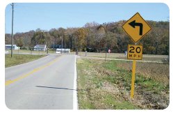
Due to limited HRRRP funds, Missouri searched for ways to stretch the funding to increase its effectiveness. One strategy combined Federal and State resources to complete the first round of HRRRP projects. FHWA provided HRRRP funds to purchase signposts for chevron sign installations around curves. MoDOT's Central Office provided chevrons from their Sign Production Center and MoDOT districts offered their maintenance personnel to install the signs. This cooperation resulted in a significant reduction in project cost.
Missouri's system-wide safety philosophy has proved effective at reducing severe crashes, particularly those involving roadway departure. The next step for Missouri was expanding the HRRRP system from the original 137 roadways to the entire system of eligible routes. By including additional roads, the State is able to address more potential severe crashes with low-cost, system-wide countermeasures.
Missouri DOT's previous standard for edgeline striping required a roadway to carry 1,000 vehicles per day. Based on recent research, MoDOT believed lowering this threshold would be beneficial. The agency lowered the traffic volume requirement to 400 ADT, adding nearly 6,000 miles of roadway to the State system of roadways with edgeline striping. Since a significant portion of this mileage (88 percent) is eligible for HRRRP funds, MoDOT is utilizing HRRRP funds for eligible routes. For consistency, the State is using its own operational funds to add edgeline pavement markings to routes not meeting the HRRRP eligibility criteria.
Missouri has leveraged its small amount of HRRRP funding to make a big difference. By the end of 2011, more than 5,000 miles of Missouri's rural highways will have HRRRPfunded safety improvements. At the same time, Missouri's statewide fatalities continue to decrease, from 1,257 in 2005 to 960 in 2008.
Signs installed with mixed funding
Working with Local Agencies
The Iowa DOT administers the HRRRP through its Office of Local Systems. The office has staff dedicated to administering county and city Federal-aid projects. Local projects are administered by the Secondary Roads Engineer, who is assisted by technical staff. This single point of contact for local agencies has provided a strong communication link to assist the local agencies with the administration of their Federal-aid highway and bridge projects. Local Systems has an extensive web site that provides guidance documents for all the aspects of Federal-aid project administration.
For the HRRRP, the Office of Local Systems collaborates closely with the State DOT's Office of Traffic Safety and Office of Transportation Data in furnishing crash and traffic data on all of Iowa's roads. The DOT also partners with Iowa State University's Institute for Transportation (InTrans). InTrans has provided technical expertise to develop crash location maps for all counties in Iowa, including qualifying HRRRP routes. Counties can annually submit applications for up to $500,000 in HRRRP funds for site-specific or corridor safety improvements.
To further assist counties with selection of HRRRP candidates and to determine appropriate safety mitigation, the Iowa DOT Office of Traffic Safety has partnered with InTrans at Iowa State to create a part-time safety liaison engineer. The position is currently staffed by a retired county engineer with extensive experience in rural road safety issues. He has been visiting all of Iowa's county engineering offices to assist in their review of qualifying HRRRP roads and to keep them informed of available safety training provided annually at no cost to the counties.
This activity has resulted in funded projects that involve shoulder widening on routes with above-average rates for Single Vehicle Run-Off Road crashes, intersection reconstruction to improve approach angles and site distance, and horizontal curve reconstruction to improve driver expectancy. A project has been initiated to replace four-way intersections with serious intersection-related crashes with roundabouts.
Road Safety Assessments (RSAs)
With 63 percent of all public highway miles on rural, locally owned systems, and with 23 percent of crash fatalities on these systems, Illinois realized the value of and difficulty in making investments to address these safety needs.
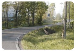
In early 2006, Illinois DOT (IDOT) conducted one of its first Road Safety Assessments (RSAs) on South Market Street in Williamson County. This RSA resulted in identification of risks related to roadway departure crashes and support of an HRRR safety improvement project. The project included 2-ft. paved shoulders, shoulder rumble strips, chevrons, strategic tree removal, fixed object modifications, and roadside hardware improvements. The total cost for the project on this 4.4-mile roadway was $867,000.
Cooperation between State and local agencies in the State and across disciplines supports this work. With the new Highway Safety Improvement Program (HSIP) funding and emphasis on locally owned roads with the HRRRP, Williamson County was an early example of a local agency that sought out new ideas for implementation.
Williamson County had a history of strong safety law enforcement efforts, evidenced by increasingly aggressive measures to enforce DUI laws in their region. But fatalities in the County were not declining. The County Engineer and Sheriff worked jointly with Illinois DOT to implement innovative traffic safety countermeasures.
In the 5 years prior to the improvements, South Market Street experienced 31 roadway departure crashes (including 16 injury and 3 fatal crashes). In the 2 years after the improvements, there have been 12 roadway departure crashes, only 1 injury crash, and 1 fatal crash.
South Market Street before improvements
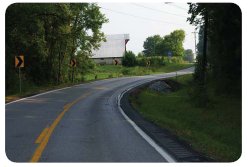
South Market Street after improvements
MPO-led HRRRP
The North Jersey Transportation Planning Authority (NJTPA) leads the annual solicitation of HRRRP projects in close coordination with the New Jersey Department of Transportation (NJDOT) for 13 counties in northern New Jersey.
HRRRP safety projects are implemented on eligible rural roads across a diverse landscape in the northern and central areas of the State. Of the slightly more than 3,800 centerline roadway miles classified as rural, approximately 636 miles are eligible segments – primarily located on locally owned roadways. These segments were identified using Plan4Safety, a GIS-based crash data analysis tool, developed by the Transportation Safety Resource Center at Rutgers University. Lists and maps of eligible segments were made available as part of the HRRRP solicitation package. In order to qualify for potential funding, projects must meet the following criteria:
A technical review committee consisting of NJDOT and NJTPA engineers and planners determines proposal eligibility and evaluates those eligible proposals on a competitive basis. Each application is reviewed and graded on several different criteria, including the requirements listed above, as well as potential for safety benefit. The committee then recommends projects for funding approval by the NJTPA Board of Trustees.
After approval is granted, applicants work directly with NJDOT staff to fulfill Federal authorization requirements. NJDOT leads the authorization process, and NJTPA maintains a monitoring and facilitation role. Additionally, the project sponsor is instructed to keep detailed before/ after crash records at the project location.
New Jersey has leveraged its HRRRP funding through NJTPA and the other two MPOs that cover the State as an effective liaison to local governments. To date, over $1.4 million in HRRRP funding has been allocated to improve safety on northern New Jersey's rural roads in the NJTPA region.
| < Previous | Table of Contents | Next > |

