U.S. Department of Transportation
Federal Highway Administration
1200 New Jersey Avenue, SE
Washington, DC 20590
202-366-4000
| < Previous | Table of Content | Next > |
Several cities lie within the boundaries of Clark County, Nevada, but most of the population resides in the City of Las Vegas or in the unincorporated Clark County area. The physical boundaries between the jurisdictions are invisible, creating a unified metropolitan area. The study area includes all of this urban and suburban area. Figure 1 provides an illustration of the Las Vegas metropolitan area or “valley”. This is the general extent of the study area.
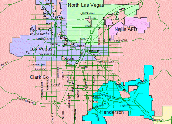
Figure 1: Cities in the Las Vegas Metropolitan Area
Conditions within the study area are consistent with those to be found in many southwestern states and in communities with a wide, fast street system. A history of high incidence of pedestrian crashes has generated awareness in the multiple agencies that govern the area. The roadways in the study area are under the jurisdiction of City of Henderson, City of Las Vegas, City of North Las Vegas, Clark County, or the Nevada Department of Transportation (NDOT). The Regional Transportation Commission of Southern Nevada (RTC) and the Nevada Office of Traffic Safety (OTS) are other entities who have administrative responsibilities for the transportation system and transportation safety in the study area.
The original downtown core of Las Vegas has been revitalized and transformed to a large casino pedestrian mall with two cross streets. With the partial exception of government and law, the gaming industry dominates the commercial activity in this urban core area. Other economic and civic activities are located away from the urban core. Streets entering this downtown area were reconstructed around the year 2000 to include curb extensions, some wide sidewalks, and landscaping, but the scale favors the motorized vehicle. Near the new mall, the homeless and the unemployed congregate near the day labor office and social services building.
Commerce sprawls out from the center and along Las Vegas Boulevard, known as the Strip. The Strip has evolved into one of the most recognizable and heavily traveled streets in the world. Designed as a Day and Night Scenic Byway, 14 of the 15 largest hotel complexes in the world are located along this roadway. An estimated 90,000 people stroll along the resort corridor every day of the peak season. The strip consists of a minimum of six lanes of through traffic. The sidewalks are often crowded with tourists and visitors with attractions such as mock facades of famous cities from around the world, fountains set to music, and an erupting volcano compete for driver attention.
Old and new residential neighborhoods were built as suburbs, disconnected from any city center, commerce, or services. Many peripheral suburbs, such as Summerlin and Green Valley, are exclusive areas connected only by high-speed arterial streets. Some cater to senior citizens, while others attract young white-collar workers. New development continued to proliferate until recently with the wide, fast streets that are the indicative of auto-oriented urbanity and the concern to pedestrian mobility and safety.
Neighborhood advisory boards and homeowner associations offer some sense of identity to some residential communities. But there is a less obvious, unique identity of place for residents in the City of Las Vegas and County areas than in other cities in the study area, such as Henderson, or North Las Vegas. These areas have better defined central areas and some geographical distinction at their boundaries.
The assets within the neighborhoods of the study area include the various boards and associations representing the interests of the community. They also include a myriad of organizations such as churches, youth groups, school district, health care providers, law enforcement agencies, emergency responders, and committed businesses that are eager to improve quality of life for those who live, work, and shop within the area. These assets are tapped and cultivated in an effort to combine neighborhood resources with local and regional resources to improve pedestrian accessibility, mobility, and safety.
Clark County, Nevada, which includes Las Vegas, has been the fastest growing metropolitan area in the country, with more than 70 percent increase in population during the last decade. The County is home to 75 percent of Nevada’s 2.495 million residents. About 40 million people from across the world visit the Las Vegas valley each year, creating a tourism industry and economic base for support businesses that lures an average of 5,000 new residents to the area each month. Entry level hotel/casino employment positions have been abundant, but most start at minimum wage.
The Hispanic population in Clark County has grown from 11.2 percent of the total in 1990 to 26 percent of the total in 2005, with an estimated 1,200‑1,500 Hispanics immigrating to the area each month. Seventy five percent of the Las Vegas Hispanic population was born outside of the United States, suggesting a potential language barrier and related limitations on transportation opportunities. According to The Latin Chamber of Commerce, Hispanics represented 55 percent of the workforce in construction industry in Clark County. Non‑white residents, including African Americans and Asians, represent an additional 17.8 percent of the total population.
About 11 percent of the population is over 65 years of age, and 25 percent of the overall population is under the age of 18 years. The number of children under 18 years of age in Hispanic families is significantly higher, representing 36.6 percent of the Hispanic population. These numbers reflect issues that need to be studied when developing treatment programs, particularly education and outreach campaigns. The culture of the Hispanic community and the needs of senior citizens set them apart from the majority of the population who often has easier access to motorized transportation.
Las Vegas is a new urban area by most standards. Its development originated during the first half of the twentieth century in a vast desert with ample land for urban sprawl. A majority of the growth in population and the economy growth in this area has occurred over the last 20 years. The low-density template used to develop the desert city provided a traditional street grid pattern with major surface arterial streets at every mile, and rights‑of‑way adequate to provide for six or eight lanes of traffic that generally travels at or above the posted speed limit of 45 miles per hour (mph). Intersections are wider, often with striped dual or triple left turn pockets, and single or double right turn pockets. A few streets have raised medians, but those with adequate width are more likely to have two‑way‑left‑turn lanes in their center. Sidewalks, when present, are generally a maximum of five feet wide and built at the back of curb, with no buffer between the sidewalk and the travel lanes for vehicles. In the 10 years between 1990 and 2000, the number of lane miles in Clark County more than doubled, for a total of 5,849 miles of lanes. Principal arterial streets and minor arterial streets account for 47 percent of urban vehicle miles of travel in the Las Vegas valley. Expansion of the roadway network continues as the area struggles to serve the growing number of vehicles, but the length of time spent commuting gradually creeps up as congestion overtakes the new roads. The Las Vegas valley is a non‑attainment area for national clean air standards.
Citizens Area Transit, the local bus system, began serving the citizens of Clark County in December 1992. In just under 10 years, ridership has grown from 15 million riders in 1993 to 61 million riders in 2006. Special bus service is available for qualified senior citizens and the disabled. The entire system consists of 46 routes served by 336 vehicles, carrying around 180,000 passengers each weekday in the greater Las Vegas Valley. Incidents such as transit system users crossing such “high speed,” “high volume” and “high risk” streets to use the transit system is not uncommon in the study area.
The Clark County School District (CCSD) is the fifth largest in the nation ‑ with an enrollment of about 308,783 students in year 2005. CCSD’s policy is that students who live within two miles of a school are not provided bus transportation by CCSD ‑ i.e., they have to walk, bicycle, get dropped off by a parent/guardian or take public transit. In spite of this policy, many school children ride buses to school, and it is not uncommon to see buses stop on seven lane, arterial streets to allow children to board and depart. Many of the older suburban schools in the Las Vegas valley are adjacent to multi‑lane arterial streets. As in many areas of the United States, schools are frequently placed in locations that require motorized transportation. Elementary aged children who cross major streets at intersections proximate to the schools that are not signalized are typically assisted by a crossing guard during school hours, but middle schools generally do not provide crossing guards. School speed zones are aggressively enforced at speeds of 15 mph for elementary and middle schools, and 25 mph for high schools. But officer resources limit the number of school zones that can be policed each day.
The City of Las Vegas and Clark County are served by the Las Vegas Metropolitan Police Department (LVMPD), a consolidated agency funded by both entities. There are approximately 1,800 officers in the department, about 130 of who are dedicated to traffic administration, patrol, and crash investigation. The agency investigates approximately 51 percent of the crashes that occur in Nevada. An inter‑local agreement with the Nevada Highway Patrol assigns traffic on and near the freeway system to the state troopers.
LVMPD conducts a variety of specialized enforcement programs, including active efforts to increase motorist compliance at marked crosswalks. They conduct regular Selective Traffic Enforcement Programs (STEPs) under traffic safety grants awarded through the Nevada Office of Traffic Safety (OTS). Pedestrian safety has become an issue for the agency and they are committed to helping with this project. One commanding officer shared his viewpoint that motorists are simply unaware of the dangers a pedestrian confronts in the street environment.
The pedestrian fatality rate in the State of Nevada had been among the worst in the nation over the past decade. Based on pedestrian fatality rates, Nevada has been among the 10 worst states for pedestrian safety since the early 1990s (NHTSA, 2004). Pedestrian fatalities per 100,000 population in the State of Nevada and the U.S. from 1994 to 2003 are shown in Table 1. Nevada has been ranked first on two occasions during the last 10 years, in 1996 and 1999, as having the worst pedestrian safety in the United States. Thus, the pedestrian safety problem (as quantified by fatal and injury crashes) in Clark County warrants immediate attention.
| Year | Pedestrian Fatality Rate per (100,000 Population) |
Nevada’s Ranking | Pedestrian Fatalities in Nevada | |
|---|---|---|---|---|
| US | Nevada | |||
| 1994 | 2.11 | 3.71 | 4 | 54 |
| 1995 | 2.12 | 3.93 | 5 | 60 |
| 1996 | 2.05 | 4.26 | 1 | 68 |
| 1997 | 1.99 | 3.52 | 4 | 59 |
| 1998 | 1.93 | 2.64 | 6 | 46 |
| 1999 | 1.81 | 3.70 | 1 | 67 |
| 2000 | 1.69 | 2.13 | 10 | 43 |
| 2001 | 1.72 | 2.15 | 7 | 45 |
| 2002 | 1.68 | 2.40 | 6 | 52 |
| 2003 | 1.63 | 2.90 | 3 | 65 |
Source: Fatality Analysis Reporting System, National Highway Traffic Safety Administration (2004)
A Geographic Information Systems (GIS) based-analysis of crash data in the Las Vegas metropolitan area was used to identify locations with high pedestrian crash rates. Altogether, 19 sites were identified as pedestrian high crash locations. Based on conditions and crash characteristics, various intelligent transportation systems (ITS) and other engineering pedestrian safety countermeasures were identified for deployment at these locations.
Various strategies to enhance pedestrian safety have been implemented and evaluated around the world. Such strategies have seen limited deployment and evaluation in the United States. Such countermeasures were deployed and evaluated at high crash locations identified within the Las Vegas valley. A before-and-after evaluation strategy was used to assess the effectiveness of these countermeasures. The successful countermeasures can be considered for similar kinds of traffic volume and site conditions throughout the United States. Some deployed novel strategies and their effects on pedestrians’ and drivers’ behavior can also be used in different parts of the world. In this research, nine countermeasures were installed and evaluated. Out of these nine, seven of the countermeasures were installed at high-risk locations. The remaining two countermeasures, an in-pavement flashing light system and pedestrian countdown signals, are installed at other locations. The effectiveness of the implemented countermeasures was evaluated under prevailing weather conditions and in the geographic location of the Las Vegas valley.
The goals of the Federal Highway Administration (FHWA) Pedestrian Safety Program are to identify, develop, deploy, and evaluate pedestrian safety countermeasures to help improve pedestrian safety (minimize risk) and walk-ability. The intent of this program is to serve as an example of what would lead to the implementation of successful pedestrian safety countermeasures across the nation. The Las Vegas metropolitan area is the region targeted for deploying and identifying countermeasures. The focus of Phase 2 of the FHWA Pedestrian Safety Program is to implement engineering and Intelligent Transportation System (ITS) based countermeasures, to evaluate the effectiveness of these pedestrian safety countermeasures for various target groups and causal (risk) factors.
The objectives of Phase 2 of the program are to follow up on the findings and recommendations of Phase 1. Specifically, these objectives are to deploy the selected countermeasures at the sites identified in Phase 1, and to evaluate their effectiveness. Some of the countermeasures deployed in Phase 2 were selected in consultation with the Florida, Miami-Dade county team. This was to permit a comparative evaluation of countermeasures at two different locations in the country.
As presented in the proposal for Phase 2: Implementation (Volume 1), the work plan to meet Phase 2 objectives and the Government’s requirements consist of the following tasks.
Disseminate the outcomes, findings, and experiences from the program through topical avenues.
| < Previous | Table of Content | Next > |

