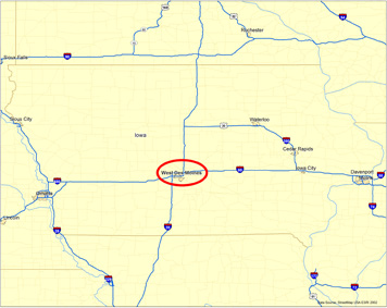
Project Location
Des Moines, Iowa
|
 |
|
FIGURE 70
The project runs through Des Moines,
Iowa. |
Figure 70 is a map of the state of
Iowa. Interstate
highways are shown on the map as blue lines with the interstate shield
on them. Des
Moines is identified in the center of the map circled in red.
|
|
|
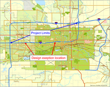
FIGURE 71
Approximate project limits of design exception. |
Figure 71 is a map showing the roadway network of the Des Moines metropolitan
area (shown in green) and surrounding areas (shown in beige). Interstate
235 is identified as a blue line labeled with a red and blue shield, with
235 in white letters. The
project limits are indicated by blue arrows that point to Interstate 235’s
intersection with Interstates 35 and 80 at an interchange north of the
metropolitan area and its intersection with Interstate 35 to the west.
The design
exception location is identified with red arrows that demarcate an east-west
segment of Interstate 235 in the western and central parts of the city.
Back to the Table of Contents

