U.S. Department of Transportation
Federal Highway Administration
1200 New Jersey Avenue, SE
Washington, DC 20590
202-366-4000
![]()
Download Version
PDF 908 KB
| 1. Report No. FHWA-SA-08-005 | 2. Government Accession No. | 3. Recipient's Catalog No. | ||||
| 4. Title and Subtitle: Tribal Road Safety Audits: Case Studies |
5. Report Date September 2008 |
|||||
| 6. Performing Organization Code |
||||||
| 7. Authors Margaret Gibbs; Sany R. Zein; Dan Nabors |
8. Performing Organization Report No. | |||||
| 9. Performing Organization Name and Address | 10. Work Unit No. | |||||
|
Opus Hamilton Consultants Ltd |
Vanasse Hangen Brustlin Inc |
11. Contract or Grant No. DTFH61-03-D-00105 DTFH61-05-D-00024 |
||||
| 12. Sponsoring Agency Name and
Address Office of Safety Federal Highway Administration U.S. Department of Transportation 400 Seventh Street SW, HSA-20 Washington, D.C. 20590 |
13. Type of Report and Period Covered Final Report May 2005 – May 2007 |
|||||
| 14. Sponsoring Agency Code | ||||||
|
15. Supplementary Notes: The Federal Highway Administration (Office of Safety and Office of Federal Lands) sponsored the RSAs reported in this document. The FHWA Office of Safety Contract Task Order Managers were Louisa Ward and then Rebecca Crowe. The FHWA Office of Federal Lands Task Order Manager was Chimai Ngo. |
||||||
|
16.Abstract The results of the tribal RSAs have been compiled in this case studies document. Each case study includes photographs, a project description, a summary of key findings, and the lessons learned. The aim of this document is to provide tribal governments with examples and advice that can assist them in implementing RSAs in their own jurisdictions. |
||||||
| 17. Key Words Safety, Road Safety Audit |
18. Distribution Statement No restrictions. This document is available to the public through the National Technical Information Service, Springfield, VA 22161. |
|||||
| 19. Security Classif. (of this report) Unclassified |
20. Security Classif. (of this page) Unclassified |
21. No. of Pages: 52 | 22. Price | |||
Form DOT F 1700.7 (8-72) Reproduction of completed page authorized
Road Safety Audits (RSAs) are an effective tool for proactively improving the future safety performance of a road project during the planning and design stages, and for identifying safety issues in existing transportation facilities. Additional information and resources on RSAs are available on the web at https://safety.fhwa.dot.gov/rsa/.
Information for the case studies reported in this document was gathered during a series of four RSAs conducted throughout the United States in 2005 and 2006, involving tribal transportation agencies of the Standing Rock Sioux, Santa Clara Pueblo, Jemez Pueblo, and Navajo Nation. The Federal Highway Administration (FHWA) and the authors greatly appreciate the cooperation of these tribes, as well as other participating agencies such as the Bureau of Indian Affairs (BIA) and state departments of transportation (DOTs), for their willing and enthusiastic participation in this FHWA-sponsored RSA series.
Road Safety Audits (RSAs) are an effective tool for proactively improving the future safety performance of a road project during the planning and design stages, and for identifying safety issues in existing transportation facilities.
The Federal Highway Administration (FHWA) Office of Safety and FHWA Office of Federal Lands commissioned a series of four tribal road safety audits (RSAs) as part of a Task Order under FHWA Contracts DTFH61-05-D-00024 and DTFH61-03-D-00105. FHWA wanted to demonstrate the usefulness and effectiveness of RSAs for tribal road agencies. The RSAs were conducted by Opus Hamilton Consultants Ltd. and Vanasse Hangen Brustlin, Inc.
The results of the RSAs have been compiled in this case studies document. Each case study includes photographs, a project description, a summary of key findings, and the lessons learned. The aim of this document is to provide tribal governments with examples and advice that can assist them in implementing RSAs in their own jurisdictions.
A Road Safety Audit (RSA) is a formal safety performance examination of an existing or future road or intersection by an independent, multidisciplinary team.
Compromises and constraints among the competing interests that typically drive a road project (such as cost, right of way, environment, topographic and geotechnical conditions, socioeconomic issues, and capacity/efficiency) are a normal part of the planning and design process. The design team has the responsibility of integrating these competing interests to arrive at a design that accommodates these interests in as balanced and effective a manner as possible. RSAs, conducted by a team that is independent of the design, enhance safety by explicitly and exclusively identifying the safety implications of project decisions. By focusing on safety, RSAs make sure that safety does not "fall through the cracks".
The RSAs followed the procedures outlined in the FHWA Road Safety Audit Guidelines document (Publication Number FHWA-SA-06-06). The procedures involve an eight-step RSA process discussed later in this case study document.
The multidisciplinary RSA team is typically composed of at least three members having a background in road safety, traffic operations, and/or road design, and members from other areas such as maintenance, human factors, enforcement, and first responders. Members of the RSA team are independent of the operations of the road or the design of the project being audited. The RSA team's independence assures two things: that there is no potential conflict of interest or defensiveness, and the project is reviewed with "fresh eyes."
RSAs can be done at any stage in a project's life:
The four RSAs conducted in this case study program are summarized in Table 1.
| FACILITY OWNER | RSA SITES | RSA STAGE |
|---|---|---|
| Standing Rock Sioux Tribe, North Dakota and South Dakota |
|
existing roads |
| Santa Clara Pueblo, New Mexico |
|
planning stage and existing roads |
| Jemez Pueblo, New Mexico |
|
existing roads |
| Navajo Nation Reserve, Arizona |
|
existing roads |
All participating tribal transportation agencies volunteered to be involved in this RSA program. Involvement in the case study program required the agency to nominate the sites for the RSA project; provide the RSA team with the materials (such as volume and crash data) on which the RSA would be based; participate in the start-up and preliminary findings meetings; and contribute at least one tribal staff member to participate on the RSA team. The RSA teams were led by two experienced and independent consultants.
Information on each of these RSAs, including background, a summary of RSA issues, and a list of suggested improvements, is included in the Appendix.
The eight steps of an RSA are shown in Figure 1, and are discussed below with reference to the case studies.
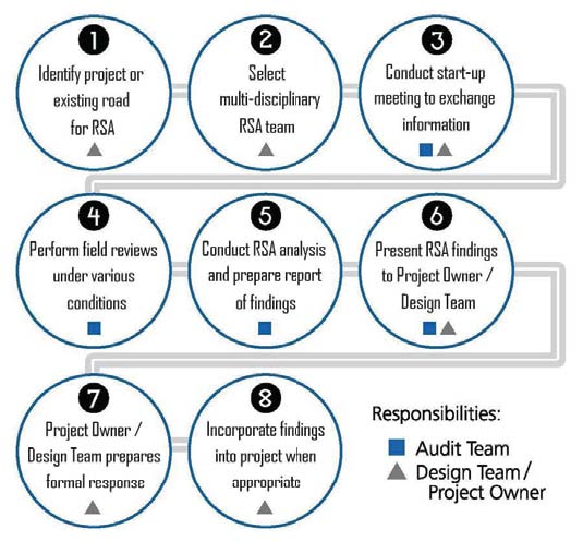
FIGURE 1 RSA PROCESS
RSA projects and the RSA team (Steps 1 and 2) were pre-selected in this FHWA case studies project. RSA teams were interdisciplinary, including engineering and enforcement staff. A pavement specialist was included in the case of the Standing Rock Sioux RSA.
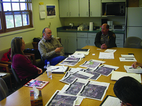
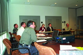
All meetings and site visits for the RSAs in the case studies project were conducted over three days. The RSAs typically began with a start-up meeting (Step 3) attended by the Project Owner (hereafter referred to as the Owner), the Design Team (Santa Clara Pueblo only), and the RSA team:
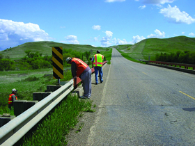
Following the start-up meeting and a preliminary review of the design or site documentation provided by the Owner and Design Team, the RSA team conducted a field review (Step 4). The purpose of the field review was to observe the ambient conditions in which the proposed design would operate (for the planning-stage RSA), or to observe geometric and operating conditions (for the RSAs of existing roads). The RSA team observed road user characteristics (such as typical speeds and traffic mix), surrounding land uses (including traffic and pedestrian generators), and link points to the adjacent transportation network. Field reviews were conducted by the RSA team under a variety of environmental conditions (such as daytime and night-time) and operational conditions (such as peak and non-peak times).
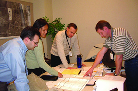
The team conducted the RSA analysis (Step 5) in a setting in which all team members reviewed available background information (such as traffic volumes and collision data). The RSA analysis methodology involved a systematic review of features at the RSA sites, including road geometry, sight distances, clear zones, drainage, signing, lighting, and barriers. Human factors issues were also considered by the RSA team, including road and intersection "readability," sign location and sequencing, and older-driver limitations. On the basis of this review, the RSA team identified and prioritized safety issues, features that could contribute to a higher frequency and/or severity of crashes. For each safety issue, the RSA team generated a list of possible ways to mitigate the crash potential.
At the end of the analysis session, the Owner, Design Team (Santa Clara Pueblo only), and RSA team reconvened for a preliminary findings meeting (Step 6). Presenting the preliminary findings verbally in a meeting gave the Owner and Design Team the opportunity to ask questions and seek clarification on the RSA findings, and also provided a useful forum for the Owner and Design Team to suggest additional or alternative mitigation measures in conjunction with the RSA team. The discussion provided practical information that was subsequently used to write the RSA report.
In the weeks following the on-site portion of the RSA, the RSA team wrote and issued the RSA report (also part of Step 6) to the Owner documenting the results of the RSA. The main contents of the RSA report were a prioritized listing and description of the safety issues identified (illustrated using photographs taken during the site visit), with suggestions for improvements.
The Owner and Design Team were encouraged to write a brief response letter (Step 7) containing a point-by-point response to each of the safety issues identified in the RSA report. The response letter identifies the action(s) to be taken, or explains why no action would be taken. The formal response letter is an important "closure" document for the RSA. As a final step, the Owner and Design Team were encouraged to use the RSA findings to identify and implement safety improvements as and when policy, manpower, and funding permit (Step 8).
Where reliable crash data were not available (or where a design was being audited), a prioritization framework was applied in both the RSA analysis and presentation of findings. The likely frequency and severity of crashes associated with each safety issue were qualitatively estimated, based on team members' experience and expectations. Expected crash frequency (Table 2) was qualitatively estimated on the basis of expected exposure (how many road users would likely be exposed to the identified safety issue?) and probability (how likely was it that a collision would result from the identified issue?).
Expected crash severity (Table 3) was qualitatively estimated on the basis of factors such as anticipated speeds, expected collision types, and the likelihood that vulnerable road users would be exposed. These two risk elements (frequency and severity) were then combined to obtain a qualitative risk assessment on the basis of the matrix shown in Table 4. Consequently, each safety issue was prioritized on the basis of a ranking between A (lowest risk and lowest priority) and F (highest risk and highest priority). It should be stressed that this prioritization method was qualitative, based on the expectations and judgment of the RSA team members, and was employed to help the Owner and Design Team prioritize the multiple issues identified in the RSA.
For each safety issue identified, possible mitigation measures were suggested. The suggestions focused on measures that could be cost-effectively implemented within likely budget limitations.
| ESTIMATED | EXPECTED CRASH FREQUENCY (per RSA item) | FREQUENCY RATING | |
|---|---|---|---|
| EXPOSURE | PROBABILITY | ||
| high | high | 10 or more crashes per year | frequent |
| medium | high | ||
| high | medium | 1 to 9 crashes per year | occasional |
| medium | medium | ||
| low | high | ||
| high | low | less than 1 crash per year, but more than 1 crash every 5 years | infrequent |
| low | medium | ||
| medium | low | less than 1 crash every 5 years | rare |
| low | low | ||
| TYPICAL CRASHES EXPECTED (per RSA item) | EXPECTED CRASH SEVERITY | SEVERITY RATING |
|---|---|---|
| crashes involving high speeds or heavy vehicles, pedestrians, or bicycles | probable fatality or incapacitating injury | Extreme |
| crashes involving medium to high speed; head-on, crossing, or off-road crashes | moderate to severe injury | High |
| crashes involving medium to low speeds; left-turn and right-turn crashes | minor to moderate injury | Moderate |
| crashes involving low to medium speeds; rear-end or sideswipe crashes | property damage only or minor injury | Low |
| FREQUENCY RATING | SEVERITY RATING | |||
|---|---|---|---|---|
| low | Moderate | High | extreme | |
| frequent | C | D | E | F |
| occasional | B | C | D | E |
| infrequent | A | B | C | D |
| rare | A | A | B | C |
| Crash Risk Ratings: | A:lowest risk level | C:moderate-low risk level | E:high risk level |
| B:low risk level | D:moderate-high risk level | F:highest risk level |
Three main factors contribute to the cost of an RSA:
The RSA team costs reflect the size of the team and the time required for the RSA, which in turn are dependent on the complexity of the RSA project. For the RSAs in this case studies project, the following cost components are noted:
For this case studies project, additional RSA team costs were incurred in travel for experienced RSA team leaders. However, typical RSAs would employ local team members, and consequently entail only minor travel costs.
The design team and owner costs reflect the time required for staff to attend the start-up and preliminary findings meetings, and to subsequently read the RSA report and respond to its findings. In addition, staff time is required to compile project or site materials for the RSA team.
The final cost component is that resulting from design changes or enhancements, which reflect the number and complexity of the issues identified during the RSA. Suggested
design changes and enhancements, listed in the Appendix (Tables A.1 through A.4) for each of the RSAs conducted for this case studies project, have focused on low-cost improvements or countermeasures where possible. Suggested improvements for the RSAs focused on improved signing and pavement markings, minor or moderate geometric changes (such as added auxiliary lanes at intersections), gateway treatments, and barrier improvements.
The primary benefits of RSAs are to be found in reduced crash costs as road safety is improved. The costs of automotive crashes are estimated by the US Department of Transportation1 as:
Other benefits of RSAs include reduced life-cycle project costs as crashes are reduced, and the development of good safety engineering and design practices, including integration of multimodal safety concerns and consideration of human factors in the design, operations, and maintenance of roads.
It is difficult to quantify the benefits of design-stage RSAs, since they aim to prevent crashes from occurring on new or improved facilities that have no crash record. However, when compared with the high cost of motor-vehicle injuries discussed above, the moderate cost of a design-stage RSA suggests that changes implemented from an RSA only need to prevent a few moderate- or high-severity crashes for an RSA to be cost effective.
The benefits of RSAs on existing roads can be more easily quantified, since pre-and post-improvement collision histories are available. As an example, the Road Improvement Demonstration Project conducted by AAA Michigan in Detroit and Grand Rapids (MI), which is based on RSAs of existing high-crash urban intersections and implementation of low-cost safety measures at them, has demonstrated a benefit-cost ratio of 16:1. Another example of data on the quantitative safety benefit of RSAs conducted on existing roads comes from the New York DOT, which reports a 20 to 40 percent reduction in crashes at more than 300 high-crash locations that had received surface improvements and had been treated with other low-cost safety improvements suggested by RSAs.
The South Carolina DOT RSA program has reported a positive impact on safety. Early results from four separate RSAs, following one year of results, are promising. One site, implementing four of eight suggested improvements, saw total crashes decrease 12.5 percent, resulting in an economic savings of $40,000. A second site had a 15.8 percent increase in crashes after only two of the thirteen suggestions for improvements were incorporated. A third site, implementing all nine suggested improvements, saw a reduction of 60 percent in fatalities, resulting in an economic savings of $3,660,000. Finally, a fourth location, implementing 25 of the 37 suggested safety improvements, had a 23.4 percent reduction in crashes, resulting in an economic savings of $147,000.
The most objective and most often-cited study of the benefits of RSAs, conducted in Surrey County, United Kingdom, compared fatal and injury crash reductions at 19 audited highway projects to those at 19 highway projects for which RSAs were not conducted. It found that, while the average yearly fatal and injury crash frequency at the RSA sites had dropped by 1.25 crashes per year (an average reduction from 2.08 to 0.83 crashes per year), the average yearly fatal and injury crash frequency at the sites that were not audited had dropped by only 0.26 crashes per year (an average reduction from 2.6 to 2.34 crashes per year). This suggests that RSAs of highway projects make them almost five times more effective in reducing fatal and injury crashes.
Other major studies from the United Kingdom, Denmark, New Zealand, and Jordan quantify the benefits of RSAs in different ways. However, all report that RSAs are relatively inexpensive to conduct and are highly cost effective in identifying safety enhancements.
The RSAs in this case studies project have been well received by all participating agencies. Characteristics of the FHWA RSAs that have promoted their acceptance by the participating agencies are generally those that are aimed at making the RSA as useful and "user-friendly" as possible.
1. identify candidate funding sources for suggested improvements
All of the tribal RSAs included suggestions for improvements to address safety issues. An important consideration in identifying and implementing road safety improvements is funding. The federal government provides funding assistance for eligible activities through legislative formulas and discretionary authority, including some funding programs based on 80/20 (federal/local) matches. The RSA team can obtain up-to-date information on funding opportunities by referring to the following resources and visiting the following websites:
![]() You will need the Adobe Acrobat Reader to view the PDF on this page.
You will need the Adobe Acrobat Reader to view the PDF on this page.
The Tribal Highway Safety Improvement Implementation Guide advises that the implementation plan for a tribal highway safety improvement project (THSIP) or highway safety project will depend greatly on which funding sources the tribes pursue, since each source has different program eligibility requirements. Some of the important government traffic safety-funding sources include:
Additional sources specific to each state may be available from the state department of transportation.
2. Preliminary RSA results (findings and suggestions) have been presented to the Owner twice, verbally and in a draft written form, to provide the owner and design Team with the opportunity for input and review before the results are documented in the final report.
Since RSA reports may become public documents and/or may be used to justify funding requests, transportation agencies may be sensitive to their contents and the way in which the RSA results are presented. To address an agency's concerns and provide it with an opportunity for input, the RSA team first discusses the RSA results in the preliminary findings meeting. In this discussion, the design team and the Owner have the opportunity to identify potentially sensitive safety issues or alternative suggestions to those that have been identified by the RSA team. In practice, the safety issues identified by the RSA team in the tribal RSA have been consistently accepted as valid, and no agency has attempted to discourage their inclusion in the RSA report. In contrast, the RSA team's suggestions for improvements have been discussed at some length.
After discussion in the preliminary findings meeting, a final set of suggestions can be identified and incorporated in the RSA report. A draft version of the RSA report is provided to the Owner for review. The Owner or Design Team can suggest clarifications or provide additional information that can be incorporated in the final RSA report. In practice, of the four RSA reports completed to date in this tribal case studies project, only minor changes to two drafts have been requested.
By discussing RSA findings in the preliminary findings meeting and issuing a draft version of the report, the RSA team, Design Team, and Owner can work together to ensure that potentially sensitive issues are appropriately presented, and that findings are presented in a way that will facilitate funding applications. It remains the responsibility of the RSA team to ensure that, while the Owner's concerns are adequately addressed, the final RSA report is an objective and accurate reflection of its findings, and that the integrity and independence of the RSA process are maintained.
3. For RSAs at an early design stage, the RSA team has provided guidance on possible low-cost improvements that could be implemented as interim measures to decrease interim crash risks.
One of the RSAs in this pilot series was conducted at the start of the planning process for highway upgrades, when construction was not expected to start for another two years. The RSA team examined safety issues and suggested safety improvements that could be implemented in the short-term and medium-term (before substantial upgrades to the corridor were completed), as well as the long-term (implemented as part of the corridor upgrades).
4. The safety benefits of a project have been identified as part of the RSA process and report.
As part of the RSA process, the team identified measures already in place (prior to the RSA) that improve the safety of road users, such as continuous sidewalk networks, shoulder rumble strips, nighttime lighting at isolated rural intersections, targeted traffic enforcement, and institutional measures that provide ongoing support for transportation safety initiatives. Acknowledging safety measures that have already been implemented puts the RSA findings in an appropriate context, and acknowledges the efforts already done by the road agency to improve the safety of road users.
5. RSA teams have been composed of a multidisciplinary group of experienced professionals.
The core disciplines on an RSA team are traffic operations, geometric design, and road safety. Beyond these core requirements, all of the RSA teams in this case studies project have included members who have brought a range of backgrounds and specialties to the RSA, including:
In this series of pilot RSAs, RSA team members were recruited from the tribe, BIA, state DOTs, and FHWA. Tribes considering their own RSAs may consider these agencies, as well as staff from other tribes with whom they establish a reciprocal relationship, when looking to staff RSA teams. When staffing a team, the RSA team leader should remember that the RSA team should be independent of the project or site being audited, as far as possible. While consultation with local involved staff is necessary to gain an adequate understanding of the project or site, the RSA team should be made up of members who have little or no prior involvement with the specific project or site.
6. RSA reports have been brief.
The RSA report is concise, and focuses on describing safety issues and suggested mitigation. Graphics and photographs were used as extensively as possible. The reports included:
Over the course of the tribal RSA case studies project, the RSA teams have identified six key elements that can help to make an RSA successful.
1. The RSA team must acquire a clear understanding of the project background and constraints.
At the RSA start-up meeting, a frank discussion of the constraints and challenges encountered in the design of the project, or operation of existing road, is critical to the success of the RSA. It is crucial that the RSA team understand the trade-offs and compromises that were a part of the design process or the form of the present road. Knowledge of these constraints helps the RSA team to identify mitigation measures that are practical and reasonable.
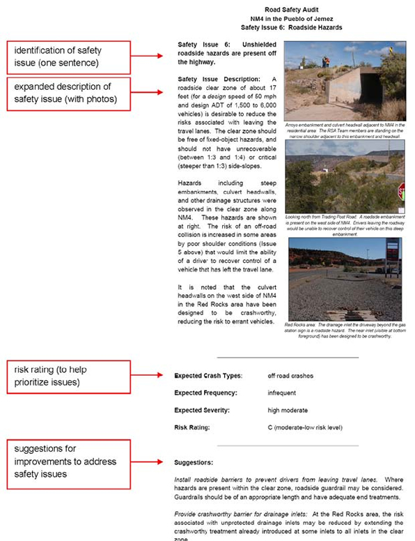
FIGURE 6 EXAMPLE DISCUSSION OF AN RSA SAFETY ISSUE
2. Recurring concerns identified in multiple tribal RSAs may reflect safety issues typical of tribal transportation environments.
RSA teams identified the following issues on at least three of the four tribal RSAs conducted in this series, suggesting that RSA teams may expect to encounter these issues during tribal RSAs:
| SAFETY ISSUE | Standing Rock Sioux | Santa Clara Pueblo | Jemez Pueblo | Navajo Nation |
|---|---|---|---|---|
| pedestrian safety, including the safety of children walking to and from school and school-bus stops |  |
|
|
|
| worn, damaged, or confusing signs and pavement markings | |
|
|
|
| hazardous roadside conditions | |
|
|
|
| limited road maintenance | |
|
|
With regard to maintenance of tribal roads, this activity has historically been funded through a range of sources, including federal and state funding sources. Funding for maintenance has typically been constrained by limited overall budgets, and by funding categories that exclude maintenance. At the same time, tribal road agencies are often responsible for an extensive network of rural roads that connect a widely-dispersed population, and that must be maintained in a harsh environment that can cause rapid pavement deterioration. As a result, road maintenance was observed to be problematical in three of the four tribal RSAs. Poor pavement conditions could result in cracked, worn, and rutted pavements, which can affect driver control and accelerate the deterioration of pavement markings.
A recognition on the part of the RSA team that the issues listed above will often be significant in tribal RSAs may help the RSA team leader to recruit appropriate expertise to address these issues. For example, the RSA team on the Standing Rock Sioux RSA included a pavement specialist from the nearby state university, who contributed his expertise to the audit team.
3. The involvement of multiple road agencies in the design, operation, and maintenance of roads on tribal lands can present a challenge, and can also help promote a successful rSa outcome.
Most of the roads audited in this series of RSAs were under the joint jurisdiction of two or three road agencies at different levels, including:
Although relations between the representatives from these agencies ranged from civil to friendly on all RSAs conducted in this series, these multiple layers can result in a large and unwieldy RSA team, and may result in conflict between members of the team. At the same time, the involvement of multiple agencies was a distinct advantage in some tribal RSAs where participants were able to call upon resources within multiple agencies to make the RSA outcome as successful as possible.
4. The RSA team and design Team need to work in a cooperative fashion to achieve a successful RSA result. it is important to maintain an atmosphere of cooperation among all participants in the RSA process — the design Team, RSA team, and the owner.
The RSA team should be consistently positive and constructive when dealing with the Design Team. Many problems can be avoided if the RSA team maintains effective communication with the Design Team during the RSA (including the opportunities presented in the start-up and preliminary findings meetings) to understand why roadway elements were designed as they were, and whether mitigation measures identified by the RSA team are feasible and practical. This consultation also gives the Design Team a "heads-up" regarding the issues identified during the RSA, as well as some input into possible solutions, both of which can reduce apprehension (and therefore defensiveness) concerning the RSA findings.
The cooperation of the Design Team is vital to the success of the RSA. An RSA is not a critical review of the design team's work, but rather a supportive review of the design with a focus on how safety can be further incorporated into it. Cooperation between the RSA team and Design Team usually results in a productive RSA, since the RSA team will fully understand the design issues and challenges (as explained by the Design Team), and suggested mitigation measures (as discussed in advance with the Design Team) will be practical and reasonable.
Support from the Owner is vital to the success of individual RSAs and the RSA program as a whole. It is essential that the Owner commit the necessary time within the project schedule for conducting the RSA and incorporating any improvements resulting from it, as well as the staff to represent the Owner in the RSA process (primarily the start-up and preliminary findings meetings).
5. A "local champion" can greatly help to facilitate the establishment of RSAs.
Wilson and Lipinski2 noted in their recent synthesis of RSA practices in the United States that the introduction of RSAs or an RSA program can face opposition based on liability concerns, the anticipated costs of the RSA or of implementing suggested changes, and commitment of staff resources. To help overcome this resistance, a "local champion" who understands the purposes and procedures of an RSA, and who is willing and able to promote RSAs on at least a trial basis, is desirable. Thus, measures to introduce RSAs to a core of senior transportation professionals can help to promote their wider acceptance. "Local champions" have been found within tribal road agencies, state DOTs, and FHWA field offices.
6. The RSA field review should be scheduled during regular recurring traffic conditions.
Where possible, the RSA team should visit the project site when traffic conditions are typical or representative. For example, the RSA on the Standing Rock Sioux reservation included the highway adjacent to a reservation high school, where recurring congestion from arriving and departing school buses was a reported issue. The RSA team scheduled site visits during the school year, coinciding with the start and end of the school day, and consequently was able to observe the congested conditions. In contrast, the RSAs on the Jemez and Santa Clara Pueblos were conducted in late October, well after the end of the summer tourist season. Consequently, the RSA teams were not able to observe tourist traffic associated with the scenic and cultural attractions on the Pueblo lands. Although this did not significantly affect the RSA findings, scheduling the field review to observe regularly recurring traffic conditions is preferable, since it allows the RSA team to see how these traffic conditions and road user behavior may affect safety.
The tribal RSA case studies project sponsored by the FHWA Office of Safety has been well received by the participating tribal transportation agencies. The case studies project has exposed tribal governments to the concepts and practices of an RSA, and provided the opportunity for tribal staff members to participate on the RSA team as part of the process. This case studies document has summarized the results of each RSA, with the intent of providing tribal governments with examples and advice to assist them in implementing RSAs in their own jurisdictions.
| Roads:existing two-lane rural tribal roads | |
|---|---|
| RSA Sites: |
|
| Environment: |  urban/urbanized urban/urbanized  suburban rural suburban rural |
| Owners: | Standing Rock Sioux Tribe, Bureau of Indian Affairs (BIA), North Dakota DOT, South Dakota DOT |
| Road Safety Audit | |
|---|---|
| Date of RSA: | 22-24 May 2005 |
| RSA Stage(s): | planning/design stage RSA of existing roads |
| RSA Team: | staff from the Standing Rock Sioux Tribe, Federal Highway Administration (North Dakota and South Dakota field offices), North Dakota DOT, South Dakota DOT, Bureau of Indian Affairs, North Dakota State University, Northern Plains TTAP, and Opus Hamilton |
The Standing Rock Sioux Tribe (SRST) reservation in North and South Dakota extends over 2.3 million acres, with an extensive rural road network of BIA, county, and state roads. The reservation roads connect the reservation's communities to each other and to the tribal administrative center in Fort Yates, ND. They also serve through traffic, and provide access to the Tribe's two casinos.
At the time of the RSA, the Standing Rock Sioux Tribe was actively pursuing improvements to transportation infrastructure on the reservation. Under the SRST Transportation Department, the Tribe had embarked on a long-range, multi-million-dollar program to upgrade community transportation facilities, using an innovative financing scheme involving government, tribal, and borrowed funds.
The Tribe maintained its extensive road network using its own funds as well as funding from sources such as the BIA. Maintenance of tribal roads was a sensitive topic, since funding for maintenance involved an extensive government allocation effort that limited the amounts available to reservations. At the same time, road maintenance was viewed as an important responsibility that directly affected tribal efforts to build a cohesive reservation community and promote economic activity. Maintenance of the roads on the SRST reservation was a challenge due to their extent (connecting a population of about 9,000 spread over 850,000 acres) and the impacts of the Northern Plains environment (winter road conditions, frost damage, and variations in the underlying water table). Although the SRST reported that it fully utilized available government funds and its own funds, the RSA team observed multiple maintenance-related issues on reservation roads, which are summarized as Issue 1 in Table A.1.
Roads studied during this RSA included ND 24 and Highway 1806 (part of BIA 3), US 12, and community access roads. Typical reservation roadways are shown in Figure A.1. The RSA team drove these roads to identify safety issues associated with road geometry, traffic operations, and maintenance. Although bridge inspection is not a usual part of the RSA process, the RSA team was asked to observe possible maintenance issues associated with a bridge on BIA 3 at Four-Mile Creek. RSA findings associated with the bridge were included in the RSA report.
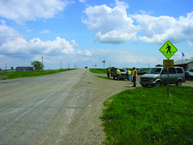
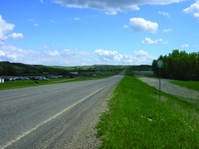
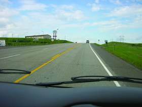
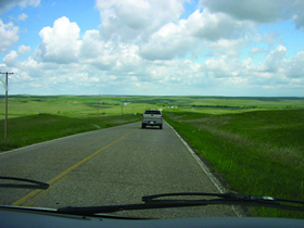
FIGURE A.1 VIEWS OF RSA SITES (STANDING ROCK SIOUX TRIBE RSA)
The key findings and suggestions of the RSA are summarized in Table A.1.
| SELECTED SAFETY ISSUE (Number and Description) | RISK RATING | SUGGESTIONS | |
|---|---|---|---|
| 1 | Road Maintenance: Limited maintenance on reservation roads contributes to poor pavement conditions and concern regarding bridge stability. | B to D |
|
| 2 | Access to Grand River Casino: Drivers turning into and out of the Grand River Casino may interfere with crossing, opposing, and following traffic on US12. | D |
|
| 3 | BIA 31 and ND 24 (School Frontage): Driver workload is potentially high near the intersection of BIA 31 and ND 24, which accommodates local, school, and through traffic. | B to D |
|
| 4 | BIA 3 and Highway 1806 (Kenel): Vehicle and pedestrian traffic may interfere with through traffic on BIA 3 through Kenel. | B to D |
|
| 5 | Hwy 1806 and US 12 (Jed's Landing): Driver workload is potentially high at the intersection, which accommodates high turning volumes and high speeds. | C |
|
| 6 | BIA 3 and ND 24: Left-turning vehicles may obstruct through vehicles at highway intersection on a horizontal curve. | A |
|
This large RSA team effectively combined members from a wide range of disciplines and jurisdictions, and included experts with relevant specialist knowledge. The core disciplines that must be represented on any RSA team are traffic operations, geometric design, and road safety. Beyond these core requirements, the Standing Rock RSA team included members with a range of backgrounds and specialties, including team members from the Standing Rock Sioux tribe, two state DOTs having highways traversing the reservation, two state FHWA field offices, the Bureau of Indian Affairs, the Northern Plains Tribal Transportation Assistance Program (TTAP) program, and North Dakota State University. The RSA team members contributed a wealth of knowledge and expertise in topics as diverse as pedestrian safety, pavement maintenance, and tribal policies, practices, and conditions.
See also the discussion of "Key Factors for Success" and "Lessons Learned" in the main text.
| Road: existing two-lane rural tribal road | |
|---|---|
| RSA Sites: |
|
| Project environment: |
urban/urbanized
suburban
rural |
| Project Owner: | Santa Clara Pueblo and New Mexico Department of Transportation |
| Road Safety Audit | |
|---|---|
| Date of RSA: | 24-25 October 2006 |
| RSA Stage(s): | planning/design stage
In-service audit |
| RSA Team: | staff from Santa Clara Pueblo, Bureau of Indian Affairs (BIA) Southwest Regional Office, New Mexico DOT (District 5), Federal Highway Administration, Gannett Fleming West Consultants, Opus Hamilton, VHB |
The Santa Clara Pueblo in New Mexico is home to approximately 11,000 residents. State Highway 30 (NM 30), which runs through the Pueblo, has an estimated AADT of 9,000 vehicles, reflecting use by:
The highway accommodates a substantial truck volume, estimated at 16 percent of AADT. Posted speed limits along the audit segment vary from 45 to 60 mph, with a 15 mph speed limit posted at a school crosswalk for two hours on school days. Two views of NM 30 are shown in Figure A.2.
The main residential area of the Pueblo is divided by the NM 30, which separates the historic center of the Pueblo on the east side of the highway from more recently-developed residential areas on the west side. The Pueblo's transportation agency has very effectively limited vehicle access to the highway by designating a limited number of access points and restricting, where possible, direct driveway access. Similarly, it encourages pedestrians to cross the highway in a safe manner by providing a marked school crosswalk that is regularly supervised by tribal enforcement officers.
At the time of the RSA, NM DOT was conducting a study of the NM 30 corridor to identify the need for upgrades. The DOT had committed approximately $8 million to implement NM 30 upgrades, starting in 2008. The RSA was conducted with a view to identify safety issues that could be addressed by the planned upgrades.
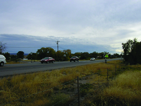
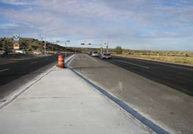
FIGURE A.2 VIEWS OF RSA SITE (THE SANTA CLARA PUEBLO)
The key findings and suggestions of the RSA are summarized in Table A.2. Where appropriate, the suggestions were divided into:
| SAFETY ISSUE (Number and Description) | RISK RATING | SUGGESTIONS | |
|---|---|---|---|
| 1 |
Pedestrian facilities:
|
D |
|
| 2 |
Narrow Shoulder and Auxiliary Lanes:
|
C |
|
| 3 | Signal operation at Puye Cliffs access road: Drivers turning from the Puye Cliffs access road may require a full signal to safely turn left onto NM30. | C |
|
| 4 | Signing and Pavement Markings: An absence of warning signs and pavement markings may increase the collision risk at merge areas. | B |
|
| 5 | Lighting: The absence of overhead lighting limits the visibility and conspicuousness of unsignalized intersections and the school crosswalk. | B |
|
| 6 | Roadside Hazard: Two signal poles are located within the clear zone at a signalized intersection. | C |
|
| 7 |
Speed limits:
|
C |
|
Conducting the RSA at the start of the parallel corridor upgrade study provided an opportunity for enhanced safety input to the corridor study. In addition to the issue-specific suggestions listed in Table A.2, the RSA team discussed longer-term suggestions to improve safety along NM 30. In particular, the RSA team recognized that the growth of the Pueblo's main residential area had generated a need to examine whether the current rural configuration and high speeds along NM 30 were still appropriate. Specifically, the RSA team suggested that NM DOT and the Pueblo consider converting the high-speed, two-lane rural highway cross-section into a four-lane urban cross-section through all or part of the Pueblo. The urban cross-section could enhance vehicle and pedestrian safety by reducing through speeds, providing facilities to better accommodate drivers turning into and out of the Pueblo's residential areas, and providing safer opportunities for pedestrians crossing the highway. In addition, since NM DOT and Pueblo staff often cited excessive speed as an issue along NM 30 (and a review of the highway collision history supported this view), the RSA Team suggested that a formal speed study could be considered as a supplement to the NM 30 corridor upgrade study.
See also the discussion of "Key Factors for Success" and "Lessons Learned" in the main text.
| Road: existing two-lane rural tribal road | |
|---|---|
| RSA Sites: |
|
| Project Environment: | urban/urbanized suburban rural |
| Project Owner: | Pueblo of Jemez and the New Mexico DOT |
| Road Safety Audit | |
|---|---|
| Date of RSA: | 26-27 October 2006 |
| RSA Stage(s): | planning/design stage RSA of existing roads |
| RSA team: | staff from Pueblo of Jemez, BIA Southwest Regional Office, New Mexico DOT (District 6), Federal Highway Administration, VHB, and Opus Hamilton Consultants |
The Jemez Pueblo, the only remaining village of the Towa-speaking Pueblos in New Mexico, is home to approximately 2,000 residents. State Highway 4 (NM 4), a minor arterial, runs through the main village area. In 2003, the highway had an estimated workweek AADT of 3,000 vehicles (rising to 5,700 over the Memorial Day weekend), reflecting use by:
Two views of NM 4 are shown in Figure A.3.
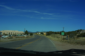
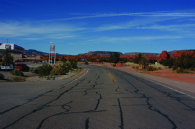
FIGURE A.3 VIEWS OF RSA SITE (THE JEMEZ PUEBLO)
The key findings and suggestions of the RSA are summarized in Table A.3.
| SAFETY ISSUE (Number and Description) | RISK RATING | SUGGESTIONS | |
|---|---|---|---|
| 1 | Frequent Uncontrolled Accesses: Uncontrolled access to properties adjacent to NM 4 increases the risk of conflicts and collisions. | D |
|
| 2 | Pedestrian Safety: Pedestrians walking along NM 4 have no dedicated pedestrian facilities. | D |
|
| 3 | Signing, Pavement Markings, and Delineation: Missing signs, pavement markings, or delineation may limit driver guidance and increase the risk of collision. Excessive signing may distract drivers. | C |
|
| 4 | Speed: Speeds above the posted speed limit increase the risk and potential severity of crashes on NM 4. | E |
|
| 5 | Deterioration of Shoulder: Shoulder conditions may deteriorate as a result of surface drainage flows and traffic. | C |
|
| 6 | Roadside Hazards: Unshielded roadside hazards are present off the highway. | C |
|
| 7 | Intersection with Bear Canyon Road: Limited sight distances, especially at night, increase the risk of collision at this intersection. | C |
|
| 8 | School Bus Operations: School buses do not consistently operate their flashing lights when picking up and dropping off students. | D |
|
| 9 | Animals on the Highway: Animals on the highway pose a crash risk. | C |
|
Cultural traditions can conflict with road safety initiatives. The RSA Team noted in its report that the Pueblo of Jemez has been supportive of efforts (like the Scenic Byways designation of NM 4) to increase tourism, preserve the environment, and improve economic development in the region. At the same time, to protect and preserve its spiritual and cultural practices, the tribe has also insisted that all recommendations for roadway improvements should consider impacts on the culture and traditional lifestyle of its members. Two examples illustrate this lesson:
See also the discussion of "Key Factors for Success" and "Lessons Learned" in the main text.
| Road: existing two-lane rural tribal road | |
|---|---|
| RSA Sites: |
|
| Project environment: | urban/urbanized suburban rural |
| Project Owner: | Navajo Nation and the Bureau of Indian Affairs |
| Road Safety Audit | |
|---|---|
| Date of RSA: | 1-3 November 2006 |
| RSA Stage(s): | planning/design stage RSA of existing roads |
| RSA Team: | staff from Navajo DOT, BIA, Arizona DOT, Federal Highway Administration, Navajo Police, and Opus Hamilton |
Highway N-12 is a rural minor arterial providing access to the Navajo capital at Window Rock, AZ. The highway, which is under the jurisdiction of the BIA, intersects I-40 near Lupton, AZ, and continues northward to US 191, passing through three states (Arizona, New Mexico, and Utah). This RSA has focused on the portion of N-12 north of Highway 264 between Window Rock and Fort Defiance, and also included two smaller sites south of Highway 264.
On the segment between Window Rock and Fort Defiance, Highway N-12 has an AADT ranging between 14,000 and 24,000 vehicles, reflecting use by:
The highway accommodates a substantial truck volume. Speed limits along the audit segments vary from 35 to 55 mph. Two views of N-12 are shown in Figure A.4.
Seven years (1999 through 2005) of collision summaries along N-12 were reviewed as part of this RSA. Over seven years, a total of 386 collisions were reported along N-12. Annual collision frequency peaked in 2002 with 60 reported collisions, and declined each subsequent year to a low of 21 reported collisions in 2005. Figure A.5 shows the spatial distribution of collisions along the entire highway segment from MP 0.0 to MP 58.5. Peaks are evident around MP 23/24 and MP 28/29, which correspond to the Window Rock and Fort Defiance areas.
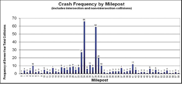
NOTE:Shows collision locations reported on N-12 over seven years (1999 through 2005). distribution is shown in one-mile segments, so (for example) all collisions at MP 24.0 through 24.9 are shown at "MP24" in the chart.
FIGURE A.4 COLLISIONS ALONG HIGHWAY N-12
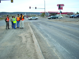
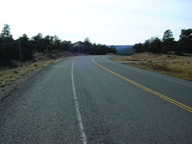
FIGURE A.5 VIEWS OF RSA SITE (NAVAJO NATION)
The key findings and suggestions of the RSA are summarized in Table A.4.
| SAFETY ISSUE (Number and Description) | RISK RATING | SUGGESTIONS | |
|---|---|---|---|
| 1 | Signing and Pavement Marking: Worn or missing signs and pavement markings may limit driver guidance, especially at night. | D |
|
| 2 | Pedestrian Facilities: The design and maintenance of some pedestrian facilities may limit their usefulness. Pedestrians who are unable or unwilling to use pedestrian facilities may use the roadway instead, where they are exposed to vehicle traffic. | D |
|
| 3 | Poor Pavement Conditions: Cracked, worn, rutted, and dusty/muddy pavement may reduce driver control (especially for motorcyclists), particularly on N-12 between N-110 and Hwy 264. | C | pavement repair and rehabilitation |
| 4 |
Intersection of N-12 and N-100 (Window rock):
|
C |
|
| 5 |
Intersection of N-12 and N-110 (Fort Defiance):
|
C |
|
| 6 |
N-12 near St Michael's School (between MP22 and MP23):
|
C |
|
| 7 |
S-curve on N-12 between MP13 and MP14:
|
C |
|
See the discussion of "Key Factors for Success" and "Lessons Learned" in the main text.

