U.S. Department of Transportation
Federal Highway Administration
1200 New Jersey Avenue, SE
Washington, DC 20590
202-366-4000
Definition: Location of midpoint of interchange (e.g., crossing route) on the second intersecting route (e.g. route-milepost). Note that if the Interchange File is a spatial data file, this would be the same coordinates as in 179. Location Identifier for Road 1 Crossing Point, the previous element.
Attributes: Route and location descriptors (e.g., route and milepoint or spatial coordinates). Must be consistent with other MIRE files for linkage.
See point A in Figure 17 for additional detail.
Priority: Critical
HPMS/Tool Requirements: None
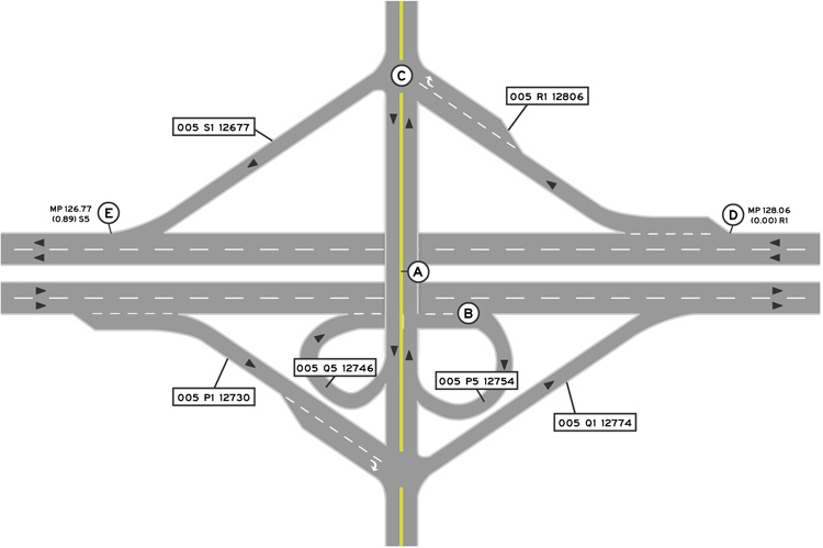
Figure 17. Illustration of Ramp Configurations.
Note: "Beginning" and "ending" of ramp is based on ramp traffic flow direction in this illustration. Agencies may choose to use another naming convention (e.g. direction of inventory).

