U.S. Department of Transportation
Federal Highway Administration
1200 New Jersey Avenue, SE
Washington, DC 20590
202-366-4000
Download Version PDF [309 KB]
Motorcoaches complete approximately 750 million passenger trips each year. Over the 10-year period from 2001 through 2010, motorcoach crashes resulted in an average of 17 motorcoach occupant fatalities per year.

These crashes often result in mass casualties that challenge EMS response capabilities, particularly in rural areas. Additionally, reliable communications to notify EMS about a crash are often not available in remote rural areas.
To address these concerns, FHWA, working with AASHTO and NASEMSO, developed a Motorcoach Roadway Safety Assessment Tool (RSAT) for States and industry professionals to use to identify and evaluate the safety of rural routes that are utilized by motorcoaches.
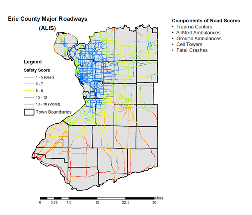
The Motorcoach RSAT employs inputs from transportation and EMS professionals to measure crash risk along a route, as well as the robustness of communications, EMS response capabilities, and proximity to hospitals and trauma centers. In essence, the Motorcoach RSAT is a collection of defined methodologies for processing, analyzing, and mapping data for the assessment of roadway safety for motorcoach travel. The tool provides data visualization, through the Google Earth platform, by rating the selected route for safety as: Blue (Best) to Green, Yellow, Orange, and Red (Worst).
The Motorcoach RSAT processor allows users to selectively browse a number of default data sets as well as process and implement new user defined data layers. Other user defined data sets that are considered relevant to the assessment of safe motorcoach travel can be imported. In addition to the included data, methodologies to add point payers, create distance based raster layers, reclassify data, combine and weight raster layers, extract point values, and convert them to Google Earth format are provided to allow user created additional safety layers and assessments.
Use of the Motorcoach RSAT requires ArcGIS software and Google Earth. For more information about the Motorcoach RSAT, visit the FHWA website at: http://safety.fhwa.dot.gov/rsat/.

